DaaS|Drone as a Service

Drone Flight Dispatch Applications

Flight Dispatch Workflow Overview

Pre-Flight Planning and Mission Preparation

Live Drone Operations and Mission Monitoring

Post-Mission Analysis and Data Delivery

Discover How Our Drone Solutions Fit Your Mission

Flight Dispatch

Read More chevron right icon

DaaS Service: Transparent Information

With A decade of UAV expertise, we know the industry inside out.

Countless hidden factors affect pricing; critical details are often missed during a quote, causing delays, sub-par deliverables, and a wide gap between the initial estimate and the final invoice.

Dragonfly UAS removes the “black box.” Our in-house software platform delivers a transparent flight-dispatch experience throughout the entire service cycle.
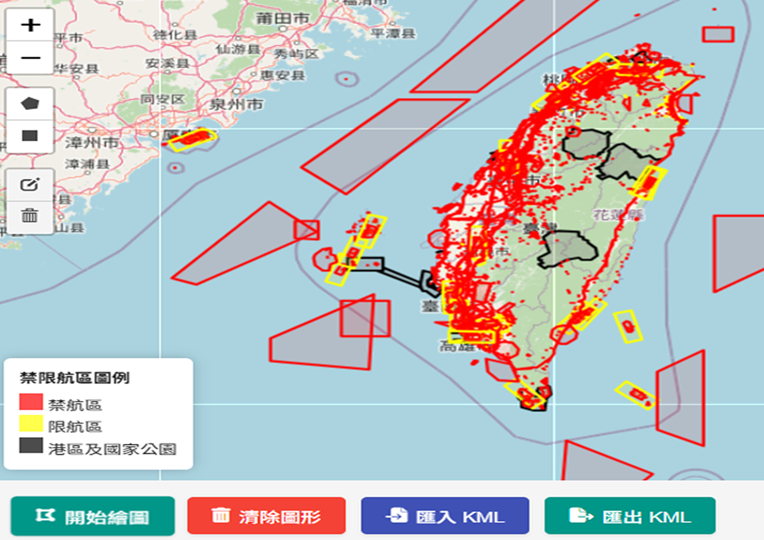
Pre-mission airspace planning and restricted zone comparison map for UAV mission pricing and flight area evaluation
Vision One Estimator
Drone mission planing and price estimate system
Before the Mission — Price Transparency
Vision OMS: Lower communication costs and produce precise mission estimates
  • Structured questionnaires help customers articulate every mission requirement.
  • Open, transparent pricing accurately forecasts total costs.
  • The air-space planning tool (with no-fly zone cross-check) gives clients a true picture of the mission timeline.
Online Estimating Service chevron right icon
During the Mission — Operation Transparency
Vision Sync: Real-time sync of UAV camera feed, remote-controller display, aircraft position, and flight path
  • Dragonfly UAS’s operations management, equipment, and pilots are all certified by the Civil Aeronautics Administration (CAA).
  • Every UAV carries full insurance, ensuring accountability for every sortie.
  • Precise flight-operation workflows boost efficiency and guarantee data accuracy.
UAV in-mission interface showing real-time flight path and synchronized video feed for progress monitoring and data accuracy
VisionSync
Flight missions in real time.
Post-mission UAV data visualization showing full flight path and coverage area for reporting and delivery
Vision GeoHub
Case management platform.
After the Mission — Record Transparency
Vision GeoHub: Mission deliverables and flight report side by side, safeguarding Taiwan’s air-space safety together.
  • Comprehensive flight-mission report
  • Complete mission-video archive
  • Full presentation of all mission data
Dragonfly UAS

Discover how our solutions fit your mission.

Contact Us